Where:
Lexington, MA
What:
Town of Lexington Conservation Property
Size:
170 acres
Access:
The intersection of Allen Street and Pitcairn Place, Lexington.
The back of the ballfield behind the Bowman School, Lexington.
Features:
The conservators of the property include the following information about the property:
Dunback Meadow is the largest Conservation Property in Lexington. Clematis Brook flows through this property, eventually emptying into Beaver Brook in Belmont. The property’s diversified landscape consists of an extensive open meadow, red pine grove, community gardens, and a red maple swamp. From the time Lexington was settled, a section of this area was known as the Hunting Swamp, and it has included a portion where peat was cut for fuel, where cows were pastured, and where hay was cut.
There are maps and photos found towards the end of this post.
A July 2009 visit
I spent an early afternoon, coming into the property from the Allen Street access. There is no parking lot but you can park along the side of the road. A small wooden sign marks the entrance. The trail went downhill from the road and then skirted the edge of the community garden area. Continuing down the trail led through an area with high, dense brush. Following along on the northeast section of the trail led to the edge of a large wet meadow. The vegetation was largely high grass and other herbaceous plants, including lots of milkweed.
We eventually made our way to a second public access point for Dunback Meadow, which is located at the back of the Clarke Middle School ballfield. The trail crossed across a number of boardwalk areas and skirted along the edge of the meadow. We briefly talked to another person that come through on his bicycle. The gentleman told us he thought he had seen a fisher on the property a few weeks earlier.
Doubling back along our route, we then ventured into the wooded portion of the property. We crossed a small waterway and some old and new boardwalk areas of the trail. The mosquitoes were out in abundance in the woods, as we expected, and we did not dally long on this part of our trip.
The visit ended with our heading out of the woods, and up the hill to the street where our cars were parked.
Maps
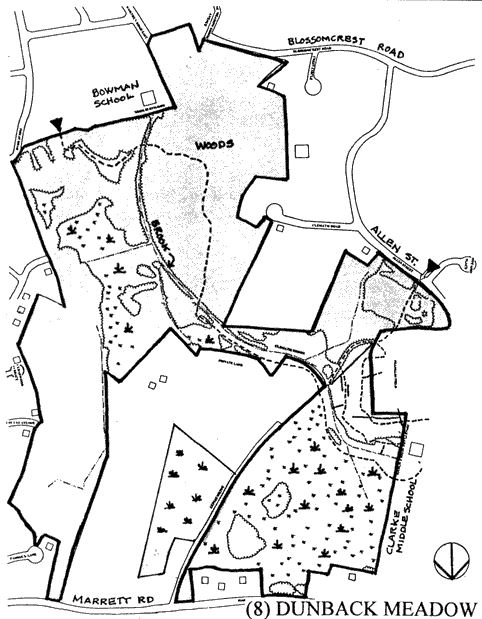
This map is upside down in comparison to the hand drawn map just above it. The approximate location of the two official entrances and a third unofficial entrance are marked by the hikers in red.
Photos
The wooden sign at the Allen Street entrance to Dunback Meadow.
The trail leading downhill from the Allen Street access.
A view looking into the community garden area.
A scene from the trail.
Looking across Dunback Meadow.
One of the boardwalks found along the trails.
A bumblebee visiting a milkweed flower blooming in the meadow.
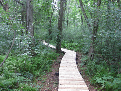
The newest boardwalk, crossing through the woodland area of the conservation property.